

Services
Merging 30+ years of land surveying expertise
Advanced drone technology delivering fast, safe, and highly accurate data. From survey-grade topographic maps and GIS data to precise volumetric calculations and detailed aerial inspections, our services are designed to enhance your project's efficiency and empower confident decision-making.

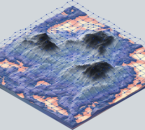
Topographic Mapping
We create highly detailed and accurate 3D topographic maps essential for engineering, design, and land use planning.
By using advanced drones, we capture comprehensive elevation and contour data far more quickly and safely than traditional methods. Our process, overseen by an Ontario Land Surveyor, ensures you receive survey-grade data that provides a precise digital representation of your site for confident decision-making.

GIS Mapping
Our GIS mapping services provide you with powerful data-rich maps for spatial analysis and asset management.
We use drones to capture high-resolution orthomosaic imagery, creating a current and accurate base layer for your Geographic Information System. This allows you to effectively visualize and manage project data, from environmental features to municipal infrastructure, all in one place.
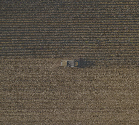
Cut & Fill Calculations
Save time and reduce costs on your next earthworks project with our precise cut and fill calculations.
Using drone-captured topographic data, we deliver fast and accurate volumetric analysis to determine the exact amount of material that needs to be moved. This service is critical for site developers and contractors to optimize their planning, create accurate bids, and monitor progress efficiently.

Aerial Inspection
Our aerial inspection services provide a safe, fast, and cost-effective way to assess the condition of hard-to-reach assets.
We deploy high-resolution cameras to capture detailed imagery of everything from cell towers to solar farms, identifying potential issues without the need for dangerous climbs or expensive equipment. With a same-week turnaround on most projects, you get the critical data you need, when you need it.
Land Surveying
We enhance traditional land surveying by integrating cutting-edge drone technology to significantly accelerate data collection.
This modern approach allows us to support Ontario Land Surveyors by rapidly capturing vast amounts of photogrammetric data for large or complex sites. This fusion of Bob McDermott's 30+ years of surveying expertise with Andrew's advanced drone operations creates unparalleled efficiency and precision.

Infrastructure Inspection
Protect your investments with our detailed building and infrastructure inspection services.
We specialize in assessing the condition of roofs, facades, bridges, and other critical structures. Our drones provide close-up visual and thermal data to identify structural defects, water intrusion, or energy loss, enabling you to conduct preventative maintenance and manage your assets more effectively and safely.